Sunriver Hikes: 15 Trails Near Sunriver Oregon
Central Oregon is a hiker’s paradise, offering a diverse range of scenic trails that showcase the region’s stunning natural beauty. From lush forests to cascading waterfalls and majestic mountain peaks, the area around Sunriver has it all. Whether you’re a seasoned hiker or a beginner, there are plenty of options for all skill levels.
In this post, we’ll explore some of the best hikes near Sunriver, Oregon, each with its own unique features and challenges. As a starting point to measure the distance, we’ve used Sunriver Resort as a reference point.
Best hikes near Sunriver Oregon
Here are the best hikes near Sunriver for quick reference. We’ll go into more detail on each trail below.
Easy hikes
- Benham Falls
- Trail of the Molten Land
- Paulina Lakeshore Trail
- Pilot Butte Trail
- Farewell Bend Park
Moderate hikes
- Fall River Trail
- Lava Butte Trail
- Deschutes River Trail
- Ann’s Butte Trail
- Paulina Creek Falls Trail
- Green Lakes Trail
- Tumalo Creek Falls Trail
Difficult/longer hikes
- Peter Skene Ogden Trail
- Lava Island Falls Trailhead
- Tumalo Mountain Trail
Benham Falls
View this post on Instagram
1.5 miles out and back | Easy
10 miles (17 minute drive) from Sunriver
Benham Falls is one of the most popular and most picturesque Sunriver hiking trails. Located in the Deschutes National Forest, the hike runs along the Deschutes River and leads to amazing cascade and rapids views.
You can access the starting point from the Benham Falls East Day Use/Trailhead. The day use area has several picnic tables as well as fully-paved accessible trails. The trail to the falls is an easy 1.5 mile out-and-back hike that is a great option for all ages and skill levels since there isn’t much of an elevation change.
Fall River Trail
View this post on Instagram
6 miles out and back | Moderate
12.5 miles (18 minute drive) from Sunriver
Fall River Trail allows hikers to enjoy views of the waters of Fall River surrounded by old growth ponderosa pines. It can be easily accessed from the Fall River Trailhead. Aside from hiking, you can also try fly fishing or catch fishermen casting their flies along the river.
The trail is considered to be of moderate difficulty since there is an elevation gain of around 100 feet. But the scenic journey through the meadows and around the crystal clear streams of Fall River make it worthwhile.
Lava Butte Trail
View this post on Instagram
4 miles out and back | Moderate
7.9 miles (17 minute drive) from Sunriver
The Lava Butte Trail is located above the Lava Lands Visitor Center. The trail loops around the crater of the summit of Lava Butte, a small cinder cone that’s part of the bigger Newberry National Volcanic Monument.
The short trail is fairly easy during the first third but it gets more steep and bumpy towards the end of the hike for a total of about 500 feet in elevation gain. But the pathways are paved so it is quite accessible. You’ll be rewarded with sweeping views of nearby mountain peaks and ranges like the Cascade Mountains to the west.
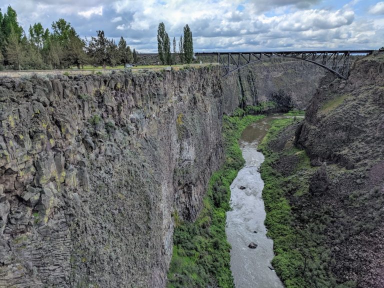
Peter Skene Ogden Trail
View this post on Instagram
18 miles out and back | Moderate/Difficult
13.9 miles (18 minute drive) from Sunriver
This trail, located near La Pine, follows Paulina Creek up to Paulina Lake in Newberry National Volcanic Monument. It’s considered to be one of the hidden gems or lesser known hikes in Sunriver so it’s very tranquil and peaceful. The hike has a bit of everything from creek views, waterfalls, volcanic rocks, viewpoint areas, and pine forests.
While the entire hike is not necessarily very challenging, the full trail is longer than others so it’s perfect for avid hikers who are looking for half-day hikes. You also have the option to hike up until McKay Crossing Campground for a shorter 12 mile round-trip hike.
Trail of the Molten Land
View this post on Instagram
1 mile loop | Easy
7.2 miles (16 minute drive) from Sunriver
This is one of the most popular easy hikes near Sunriver. This unique trail takes you through a volcanic landscape of twisted lava flows with colorful interpretive signs filled with information about the story of the eruption of Lava Butte and the geology of the area.
It’s a very short hike (less than a mile long), with an elevation gain of around 125 feet and is considered to be easy. There are sections that are newly reconstructed and paved, making it accessible for all, but the older sections might be a bit more rocky and uneven without assistance.
Ann’s Butte Trail
View this post on Instagram
4.5 mile loop | Moderate
4.4 miles (11 minute drive) from Sunriver
This is a moderate hike that loops around Anns Butte. It features well-maintained trails with a steady, gradual incline and an elevation gain of around 400 feet. It is manageable for hikers of most levels except for the steep climb towards the peak. If you’re looking for hikes that are less crowded, then this is a great spot. Along the way, you’ll be rewarded with some views of Broken Top and Mt. Bachelor.
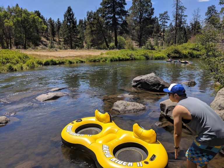
Deschutes River Trail
View this post on Instagram
6.4 miles out and back | Easy
16.8 miles (21 minute drive) from Sunriver
The Deschutes River Trail is one of the most popular hikes in Central Oregon. This beautiful trail can be easily accessed from Sunriver and many trailheads but one of the most convenient ones is from the Meadow Day Use Area. The area has lots of parking space (requires a recreation pass) and offers many areas for picnicking next to the river.
The mostly flat trail is well-maintained and has amazing river views all along the way. It’s one of the best hikes for those with younger kids or people with limited mobility since you can leisurely walk along the river up to whichever point you prefer.
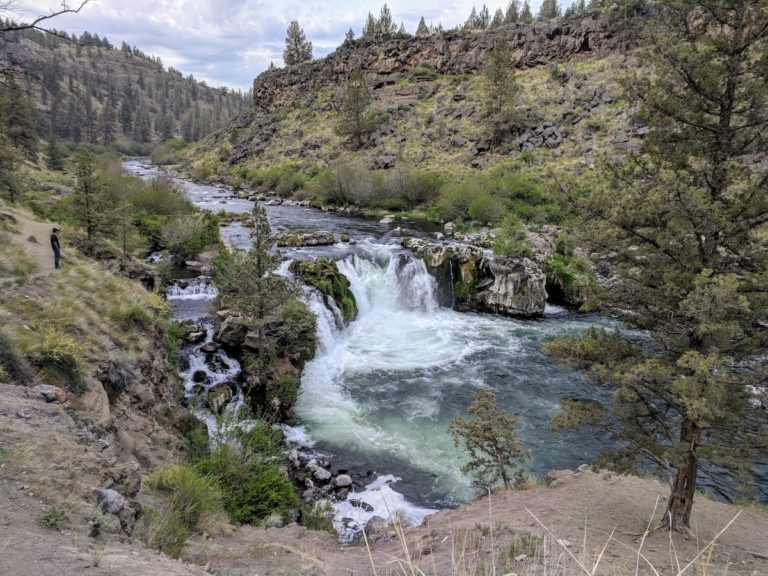
Paulina Creek Falls Trail
View this post on Instagram
5.4 miles out and back | Moderate
23.2 miles (32 minute drive) from Sunriver
Paulina Creek Falls is a stunning waterfall known for its double side-by-side drop of 80 feet. The waterfall cascades over volcanic cliffs onto a jumble of rocks. The trail itself starts at the Paulina Falls Day Use Area near Paulina Lake Road. The trail leads hikers to both the top and the bottom of the falls.
This out-and-back trail is moderately challenging since the elevation gain is over 750 feet but the path is fairly straightforward. The views at the end of the waterfalls and the lake are definitely worth it.
Paulina Lakeshore Trail
View this post on Instagram
7.5 mile loop | Easy
23.5 miles (32 minute drive) from Sunriver
If you have time and energy after hiking Paulina Creek Falls, then another nearby hike you can do is the Paulina Lakeshore loop. It’s also located within the Newberry National Volcanic Monument and feeds into the falls. The lake itself is fed by hot springs and is home to a rich ecosystem of various species, making it a great place for fishing.
The scenic hiking trail loops around the lake and is mostly flat with some rocky areas and occasional steep climbs and descents. Along the way, hikers can take in the breathtaking views of the crystal-clear waters of the lake and falls, as well as the rugged Cascade Mountains in the distance.
Lava Island Falls Trailhead
View this post on Instagram
13.2 miles out and back | Moderate
15.5 miles (32 minute drive) from Sunriver
Lava Island Falls are rapids on the Deschutes River. The rapids are rated a class 5, meaning they are difficult to navigate due to an island of lava from Lava Butte that blocked part of the river. As such it’s not recommended to travel through it downstream but it makes for a unique hike.
This long river trail follows the Deschutes River with a lot of varying scenery. It offers great views of the river, lava rocks, and unique geological formations. The trailhead is easily accessible through the Lava Island Day Use Area.
Tumalo Mountain Trail
View this post on Instagram
4 miles out and back | Difficult
19.3 miles (27 minute drive) from Sunriver
If you are an experienced hiker, then this is one of the best hiking trails to do near Sunriver. This 4-mile hike is considered strenuous because of the elevation gain of around 1,500 feet. The trail starts in a dense forest and gradually ascends through switchbacks until reaching the steep summit of Tumalo Mountain.
This top of the mountain offers some of the best views in Central Oregon. You’ll be rewarded with panoramic views of the surrounding mountains which include Broken Top, Mt. Bachelor, and Three Sisters. The trail tends to be covered in snow during the winter months so make sure you check the conditions beforehand and have the appropriate gear. If you want to avoid snow, then June to October are the best recommended times.
Green Lakes Trail
View this post on Instagram
9.1 mile out and back | Moderate
24.4 miles (35 minute drive) from Sunriver
Green Lakes Trail is located in Three Sisters Wilderness. The trail starts at the Green Lakes/Soda Creek Trailhead and follows along Fall Creek before eventually reaching the breathtaking Green Lakes. In the lakes, you can take a refreshing dip in the crystal-clear water or enjoy a picnic on the shore.
The trail is generally considered to be a moderate to strenuous hike due to its rocky, bumpy terrain and its elevation gain of around 1,187 feet. But the beautiful views of alpine lakes, towering peaks, and lush forests make it a rewarding journey.
Pilot Butte Trail
View this post on Instagram
1.8 miles out and back | Easy
19.1 miles (29 minute drive) from Sunriver
Pilot Butte is a prominent cinder cone located just east of Bend that’s a popular destination for hiking, picnicking, and catching the sunset. The butte offers panoramic views of the city of Bend as well as the surrounding mountains, including the Three Sisters, Mt. Jefferson, Black Butte and Mt. Hood.
There are several trails to reach the summit of Pilot Butte. The easiest one is a quick mile each way from the base to the top. It’s a fairly short hike and steady incline up the hill. For those looking for something a bit more challenging, you can look into the Pilot Butte Extended loop. Both are great trails. Since the trail spirals around the hill, you get views in every direction along the way.
Farewell Bend Park
View this post on Instagram
1.1 mile loop | Easy
16.6 miles (23 minute drive) from Sunriver
Farewell Bend Park is a beautiful park located in Bend, Oregon, just a short drive away from Sunriver. The park sits on the banks of the Deschutes River and is home to a variety of recreational activities, including hiking trails, picnic areas, playgrounds, and water activities like fishing, kayaking, and stand-up paddleboarding.
One of the main attractions of Farewell Bend Park is the scenic river trail that follows the Deschutes River. The trail is easy and mostly flat, mixed with mostly paved walkways and some dirt sections. It’s perfect for leisurely walks and jogs along the river or a fun, relaxing family outing.
Tumalo Falls Trailhead
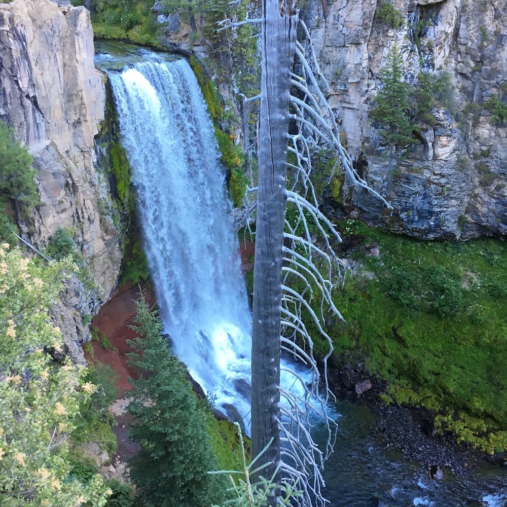
6 miles out and back | Moderate
30.2 miles (47 minute drive) from Sunriver
The Tumalo Creek Falls is a 90-foot waterfall located in the Deschutes National Forest in the Cascade Range near the west of Bend. It is a popular destination for outdoor enthusiasts, as you’ll find hiking trails, mountain biking trails and scenic views of the falls. It can get quite busy especially during weekends so make sure to get an early start.
There are several trails surrounding the falls. Most start from the Tumalo Falls Day Use Area. One of the most popular ones is the North Fork Trail, a wide dirt rail that goes steadily uphill. Total elevation gain is around 1,033 feet. The first parts are the most steep but not too strenuous. As you keep going, you’ll see more smaller waterfalls like Double Falls, Middle Tumalo Falls and the Upper Falls. For more information on the North Fork Trail, check out our full guide of the hike!
Other variations of this hike include the Bridge Creek Trail, Tumalo Creek Trail, and Farewell Trail. Some are more challenging than others but all offer great views of the falls.
Sunriver, Oregon, and the surrounding areas offer great hiking opportunities in Central Oregon. From leisurely strolls to challenging summit hikes, there is something for every type of hiker.
All of the hikes listed above are just a few of the best Sunriver hiking trails. Many of the trails have different variations and discovering them all can make for the best outdoor adventures!
Let us know in the comments: What is your favorite hike near Sunriver?
Like this post? Pin it for later or share with friends!