Where to See Waterfalls in Central Oregon: 16 Falls Near Bend
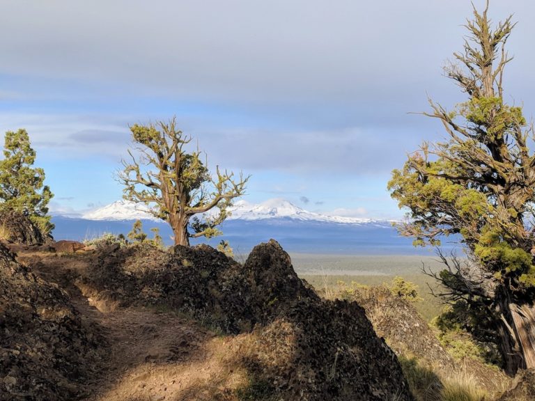
One of the best things to do in Central Oregon is hiking. What’s even better is hiking trails that lead you to panoramic views of waterfalls, cascades, and rapids.
The waterfalls in Central Oregon all boast of unique natural beauty. Some were formed over lava formations, while some have impressive tall drops. Not to mention that the trails to see these falls are paved with gorges, rivers, dense forests that are equally as breathtaking.
Whether you’re an experienced hiker looking to brave steep inclines or you’re looking for an accessible viewpoint for great views, these waterfalls are definitely worth adding to your Central Oregon itinerary.
Best Waterfalls Near Bend and Redmond, Oregon
Here is a list of the best waterfalls to see near Bend and Redmond. Most waterfalls have information on the hiking trails to take to the waterfalls.
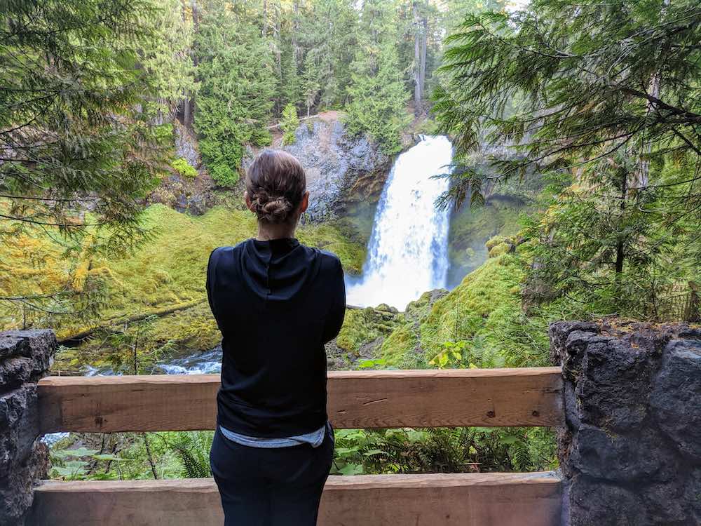
Tumalo Falls near Bend Oregon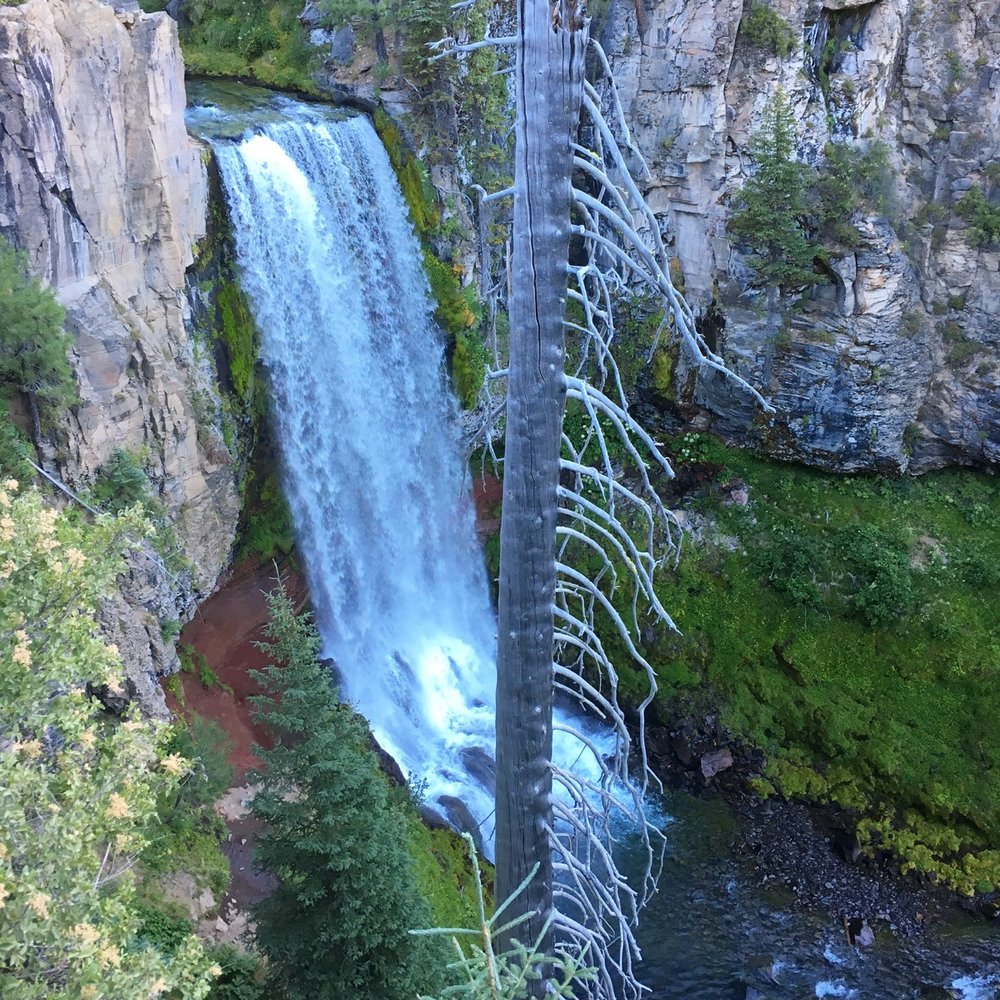
Tumalo Falls is easily one of the most recognizable and photographed waterfalls near Bend. Falling from a cliff in the Deschutes National Forest, Tumalo Falls is a nearly 100-feet tall waterfall located in Tumalo Creek in the Cascade Range.
The scenic drive to Cascade Range from Bend is only around 30 minutes. Though the Tumalo Falls road is unpaved gravel road, the drive is manageable.
Since it’s quite near to Bend, it’s a popular spot for weekend getaways. Aside from waterfall views and hiking trails, there are picnic areas and mountain biking trails.
There are also several vantage points from which to see the falls. It’s already quite visible from the start of the trailhead parking lot but you’ll encounter better views as you continue along the Tumalo Falls Trail Hike.
Tumalo Falls Trail Hike
6.5 mile loop | Moderately Difficult
As mentioned, the Tumalo Falls Trail Hike offers various perspectives from which to see the falls. From the parking lot, you’ll already get a nice unobstructed view. But the North Fork Trail actually begins on the left after the fee station.
The wide dirt trail goes steadily uphill, with the first section being the steepest. It’s a relatively short distance of around half a mile to the viewpoint. From here, you’ll be at the top looking down the cascade.
If you keep going, you’ll be rewarded with even more waterfalls. The dirt trail becomes narrower and continues uphill and you’ll get to see four more waterfalls at 4 miles in. Reports vary on how many waterfalls there are in total (around 8 to 10) but you can try completing the full loop.
Click here for a detailed overview of the Tumalo Falls Trail Hike >
Find more places to discover on our interactive Central Oregon map:
Sahalie and Koosah Falls
Sahalie Falls and Koosah Falls are two falls connected by a hiking trail of easy access from one another. These amazing waterfalls are located along the McKenzie River in the Cascade Mountains.
Sahalie Falls also stands at 100 feet and cascades down to a natural dam that was formed from lava. On the other hand, Koosah Falls is smaller at around 70 feet but with a much deeper pool at the bottom.
Sahalie Falls Hike
2.6 mile loop | Easy
This easy hike starts in the Sahalie Falls parking area where you can already see a viewpoint of the falls. Heading downstream for around half a mile, you’ll pass by smaller cascades and a canopy of trees before reaching the first viewpoint for Koosah Falls.
If you continue going upstream, you’ll be able to see both falls from different angles and from much higher up. This hike is actually part of a larger trail called Mckenzie River Trail. If you have more time, you can hit up even more spots like Clear Lake and Blue Pool.
Steelhead Falls Short Waterfall Hike
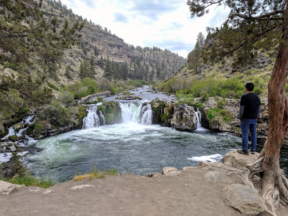
Steelhead Falls is located around 45 minutes north of Bend and 25 minutes away from Redmond. It is not far from Cline Falls and Eagle Crest Resort.
The Steelhead Falls park can also be a great spot for swimming during the summer. During the winter months, it’s a pretty popular place for fishing.
Steelhead Falls Trail Hike
0.5 miles one way | Moderately Difficult
This is another short hike that has moderate ups and downs and a small incline. Following the main trailhead is not that challenging but you have to be cautious of the loose ground. As such, it may not be ideal for smaller children.
The trailhead will take you through a winding gorge and canyon along the Deschutes before reaching the waterfall viewpoint. During summer, you’ll catch people swimming beneath the falls.
Click here for a detailed overview of the Steelhead Falls Trail Hike >
Proxy Falls, Central Oregon
Proxy Falls is located around an hour and a half away, northwest of Bend. It’s a group of falls so the trail brings you to two stunning waterfalls – Upper Proxy Falls and Lower Proxy Falls. The latter is actually one of the highest plunge waterfalls in Oregon, with an impressive main drop of 226 feet.
Proxy Falls Hike
1.5 mile loop | Easy
The Proxy Falls trailhead takes you west into the Three Sisters Wilderness. The trail loops around dense pine forests and old lava fields, making for some rocky sections though it’s much more even in the forest.
The trail splits into two with each taking you to either of the falls. The way down to the Lower Proxy Falls is a bit steep so you can stick to the lookout point at the top of the trail. The main trail leads you to Upper Falls which tumbles down into glacier-cut cliffs.
This short hike is best done during the warm summer months. As such, keep in mind that this hike is only open during certain times of the year (July-November) depending on the snowfall.
Wychus Falls and Chush Falls
These two beautiful waterfalls lie in the Whychus Creek in the Cascade Range southwest of Sisters and on the west of Bend.
This area was hit by the Pole Creek Fire years back so unfortunately the trail and landscape were affected dramatically. You can see how it affected the area by the hauntingly beautiful burnt forests along the way.
Whychus Creek and Chush Falls Hike
5-6 mile loop | Easy
Before the fire, the hike used to be a 2-mile loop but now it’s around 5 to 6 miles. The trail is not particularly well-maintained but it’s not especially difficult. When you’re approaching the creek, there is a small incline that leads you to the top of Chush Falls.
For more spectacular views, you can follow the path going down to the base of the waterfalls. Here you’ll see the falls cascading into a pool surrounded by a lush and mossy meadow.
Marion Falls and Gatch Falls
Marion Falls and Gatch Falls are located about an hour northwest of Bend. The area is a great place for hiking since there are also trails that lead to nearby lakes. If you’re making your way to these falls, you can easily make your way to Lake Ann and Marion Lake as well.
Marion Falls Hike
5 mile loop | Moderately Difficult
The hike to Marion Falls is a pretty popular trail but people usually take it to head to Marion Lake. The way to the waterfall is off-trail through the forest. It starts at a steady incline that will soon lead you to Lake Ann.
After a short walk, you’ll come across a well-marked trail that leads to a good view of Marion Falls. If you make your way further down to the base, you’ll also catch Gatch Falls in the view. We recommend wearing proper hiking shoes for this since the descent is steep.
Cline Falls: Easy Waterfall Hike near Eagle Crest
 Cline Falls is around 30 minutes outside of Bend, near Eagle Crest Resort. It’s along the Deschutes River and also a short way from Steelhead Falls.
You can start your journey off the Mackenzie Highway on the Cline Falls State Scenic Viewpoint, a parking area with a picnic area and fishing access.
There are several dirt paths that go along the river to the falls. It’s an easy and relatively flat hike, with not much elevation gain. The falls drop down into a canyon into many small spilling cascades.
Click here for a detailed overview of the Cline Fall Walk >
Linton Falls
Linton Falls is an impressive waterfall near Bend, about 30 miles northwest in the Central Cascade Mountains. The falls stand tall at a total of around 615 feet, consisting of eight drops. The final drop is the tallest, cascading at around 85 feet.
Linton Falls is surrounded by thick forests and sloping terrains but you are sure to get one of the best views at the end of your journey.
Linton Falls Hike
4.3 mile loop | Moderately Difficult
This waterfall hike is one of the more challenging ones in this list because of the elevation gain and the uneven terrain and landscape. The first 1.5 mile hike at the beginning starts fairly easy since it’s a well-defined path through a series of lava paths.
It gets more challenging after that, with muddy paths and fallen trees on the way uphill. At the end you’ll be rewarded with an amazing view of the lower Linton Falls. If you are feeling brave, you can go past by climbing directly upstream to get a fuller picture of all the falls.
Paulina Falls and McKay Falls
_-_01.JPG) Another Believer, CC BY-SA 4.0, via Wikimedia Commons
Another Believer, CC BY-SA 4.0, via Wikimedia Commons
Paulina Falls is one of the popular waterfalls that’s a must see in Central Oregon, about 40 minutes south of Bend. It’s part of the Newberry National Volcanic Monument, so you can expect to see some volcanic cliffs surrounding the falls.
Along the way, you’ll also get to see the nearby McKay Falls at the McKay Campground Site along Paullina Creek in the Deschutes National Forest.
Peter Skene Ogden Trail Waterfall Hike
8 mile loop | Moderately Difficult
The Peter Skene Ogden Trail is actually lined with plenty of waterfalls. The main trail is an 8-mile hike but you can continue or stop at any point you like.
One of the best places to start would be the McKay Campground Site where you’ll see the first falls, McKay Falls. After the first part of the hike, you’ll see Paulina Creek which leads into the rapids. Follow alongside the rapids to get to the Paulina Creek Falls.
There are two viewing points for Paulina Falls. You can see it from the lower viewpoint or upper viewpoint, which is less than 0.25 miles from the parking lot. Both offer spectacular views of the 80ft waterfall.
Check out our list of other bucket list hikes in Oregon >
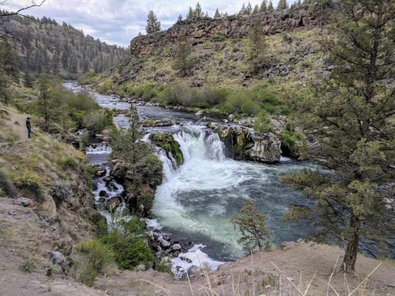
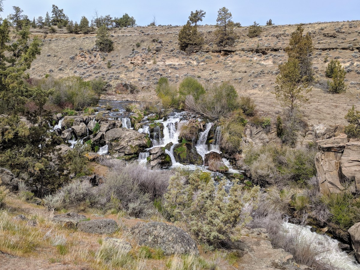
Lava Island Falls, Benham Falls, Dillon Falls
_-_23.JPG) Photo: Another Believer, CC BY-SA 4.0 via Wikimedia Commons
Photo: Another Believer, CC BY-SA 4.0 via Wikimedia Commons
This group of three waterfalls are all in close proximity to each other along the Deschutes River southwest of Bend.
The most popular waterfall of the three is Benham Falls. It’s also the largest and most impressive of the three. Dillon Falls is a bit harder to see but you’ll be able to see more of the lava formations and the surrounding gorge. Lava Island Falls are also quite scenic but much harder to reach.
All of these waterfalls are much more like rapids than tall, cascading waterfalls. The best time to see them would be during spring when the water is gushing.
Deschutes River Trail Waterfalls Hike
6.8 mile loop | Easy/Moderately Difficult
This trail starts at Benham Falls along a river trail that takes you to a pine forest. Continuing along the way you’ll make your way to some steep inclines with dramatic landscapes of some lava features and gorges, especially leading to Dillon Falls.
Lava Island Falls is a much more challenging hike. It’s hard to access since the inclines are steeper and there are private properties along this portion of the river.
Wizard Falls, Metolius River
Wizard Falls along the Metolius River is not your typical waterfall cascading down staggering heights. It looks more like a set of rapids that tumble down a ledge of the river. It’s worth visiting for the rich blue color of the water, which makes for great pictures.
There’s plenty of other natural landscapes to admire along the Metolius River Trail. The river trail leads you into springs and beautiful river views. Towards the end of the trail you might even stumble into the Wizard Falls Fish Hatchery where you can feed the fish in an open-air pond.
If you love nature and scenic views, you can’t go wrong with spending a day sightseeing and hiking to any of these Central Oregon waterfalls. Each waterfall has its own unique landscape and beauty! Simply choose a hike that fits your skill level and discover the beauty of Central Oregon.
Read next:
Central Oregon Hikes
Best Vacation Resorts in Central Oregon
Things to do in Redmond
Things to do in Sisters
Scenic Drive to Central Oregon
Like this post? Pin it for later or share with friends!